
West End, Downtown, West Side 24.6 Miles September 1, 2021 When it comes to bike rides for the blog, (which I call “Official” rides) regular readers know I do the […]

A Look Back at a Kid’s View of Williams Hill
By the 1950s, most of the houses had been removed from Williams Hill. Those that remained were in rough shape. Courtesy MnHS

Riding Across the City, Riding Across the Country
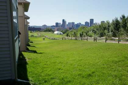
Downtown Saint Paul’s taller buildings peeked above the tree line and Pig’s Eye Lake. Left to right, Wells Fargo Tower, First National Bank Building, 400 Securian Center, Airye Condominiums (formerly Jackson Tower, Cray Plaza and Galtier Tower) the two buildings on the right.
In, out and around Railroad Island
September 23, 2019 23 miles Summit-University, Frogtown (Thomas-Dale), Downtown, Railroad Island (Payne-Phalen), North End, Midway, Lexington-Hamline, Macalester-Groveland, Highland Park Downtown Minnesota’s stunningly beautiful and recently renovated Capitol building obviously is […]

Schools, Pools, Beer and Deer
Macalester-Groveland, Highland Park, West End Saturday, September 6, 2014 11.9 miles: Students in Saint Paul went back to school this week, making the visit one of my favorite school buildings, […]