
The hilly West Side has its ups and downs-literally, the notch in St. Paul’s southern border and stumbling onto a geodesic dome house on Morton Street.

Sylvan Sights Around a Cemetery
21 milesOctober 18, 2021Como, North End The map of the October 18, 2021 ride. Sylvan means relating to, or inhabiting the woods. While the ride didn’t start that way, the […]

The Native Street Names On the West Side
September 6, 2021 West Side 18.2 miles The map of the September 6, 2021 ride. The northwest section of the West Side (the Cherokee Park neighborhood) has several streets named […]
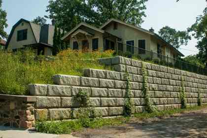
The ‘Irregular Hillocks, Ridges and Hollows’ of St. Anthony Park
August 25, 2021 20.8 Miles St. Anthony Park I’d never thought of St. Anthony Park as being unusually hilly. That is, until this ride. About halfway through it dawned on […]

Shutter Spotting Around the City
Shutters are more common on Saint Paul homes than I thought. Shutters more frequently adorn homes of certain architectural styles, such as Queen Anne, Dutch Colonial and ramblers (a.k.a. ranch.) Of course, that statement is based on my random, unscientific observations.

Totem Town Trek
September 7, 2015 34.5 Miles West End, Downtown, Dayton’s Bluff, Battle Creek, Highwood Hills A long ride to the eastern reaches of Saint Paul, which started with some quick stops, […]

Combing through Minnesota’s Attic
25.6 miles (11.86 miles to MnHS; 13.74 miles home) Macalester-Groveland, Summit-University, Frogtown, North End, Payne-Phalen After months of conversation, coordination, and anticipation I was finally on the way to the […]

Just Ryde’n Around
August 14, 2015 Macalester-Groveland, Merriam Park, Lexington-Hamline, Como Park 16.2 Miles Cleveland Avenue, because of its proximity to my house, is the north-south street on which I ride […]
Signs and Symbols
August 12, 2015 12.2 Miles Macalester-Groveland, Lexington-Hamline, Summit-University (Rondo), Summit Hill This sign is a great summary of how I feel about Summer. Except for the fishing part. How I […]

Digging History
July 31, 2015 Lexington-Hamline, Downtown, Swede Hollow 17 miles “History” is an interesting word. Sure, it refers to the past, but history ranges from a moment ago, to as far […]