Frogtown (Capitol Heights, Mount Airy), Payne-Phalen, East Side (Dayton’s Bluff)
27 Miles
July 14, 2018
Capitol Heights
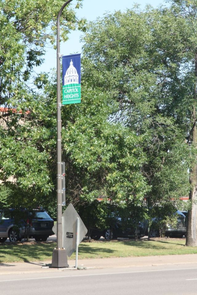
There is a small section of Frogtown, immediately north of the Minnesota State Capitol, that has been known as Capitol Heights for more than a century. That was stop one on my ride.
Once called Sherburne Hill, it evolved into a busy residential neighborhood in the 1880s. Located within the area surrounded by University and Pennsylvania Avenues, Rice and Jackson Streets, the approximately 20 square block neighborhood consisted of a couple dozen mansions, some simple apartment buildings and single family residences.

Some well-to-do Saint Paulites began building estates in Sherburne Hill as Lowertown transitioned from primarily residential to industrial. Among them were the Merriams, whose name adorns Merriam Park.


Because of its proximity to the Minnesota State Capitol – just north of the granite State House – Sherburne Hill was renamed Capitol Heights in the early 1900s.
Today Capitol Heights is dominated by humdrum State of Minnesota government buildings and government-related office edifices, Bethesda Hospital, parking ramps and parking lots, with some homes mixed in.


Bethesda Hospital and related structures take up nearly two city blocks between Park Street and North Capitol Boulevard on the west and east respectively, Como Avenue on the north and Sherburne Avenue to the south. Bethesda, established to serve Swedish Lutherans, opened its doors to its first patient in 1883 in a building near Lake Como. Eight years later the hospital moved to a new home in Lowertown, a former mansion.


Bethesda Hospital opened the original wing of its current building at 559 Capitol Boulevard in 1932 following a year of construction.


The pastoral Therapeutic Garden and Park are part of the Bethesda Hospital property. The manicured grounds are for patients and their families but the area is open to neighbors too.


Not that I’d given it any thought before, but I was surprised that Como Avenue and Cedar Street meet. My view was that Cedar was strictly a Downtown Street, and Como Avenue didn’t venture this far south.
Anyway, there is an attractive Painted Lady at 37 Como Avenue, next to the light and street sign post noting the intersection of Como and Cedar Street. I interrupted the woman doing yard work there.

Bonnie Erickson and I gabbed about her beautiful Victorian home and the unusual story of how she and her husband acquired the more than 100 year old home in 2004.

Bonnie, a realtor, got a call from a former client who was being deployed by the military to Bosnia and needed to sell the apartment building he purchased with her help years before. Complicating the deal was the client also had a house (37 Como) to sell and he wanted to package both into one deal. “We’re on the phone and I rolled my eyes. It’s not gonna happen. I mean people who buy houses don’t buy apartment buildings at the same time.”
Meantime, Bonnie’s husband Ken had become more vocal about his dislike of mowing their one acre suburban property and was pushing to buy a Victorian home to renovate. Despite knowing better, Bonnie and Ken bought the house and the apartment building. “We knew we overpaid for it but we wanted the house. I’m a professional and if it was my client, I would have said don’t go there. But I went there with my eyes open.”
Not surprisingly, the house was in disrepair. Years of neglect and vandals significantly damaged the interior, though some deterioration resulted from the previous owner having the house moved from 706 Robert Street to 37 Como Avenue.

Most noticeable inside were sizeable holes and graffiti spray painted on the plaster walls. The only elements in the kitchen were a 42-inch sink base, an “ugly makeshift island” and a closet with wire shelves. But all that paled compared to the attic. “There were four-by-four boards in a square with a painter’s tarp over it, with this much water in it,” Bonnie told me, holding her hands several inches apart. “The roof leaked and we had scheduled to have it replaced immediately, but we weren’t expecting to inherit the water too. I’m sure that had been leaking for years because there was decay clear down on the main floor from water damage.”
“My kids just looked at us and said, ‘What on Earth were you thinking?’ and I got to thinking ‘What on Earth was I thinking.’”
Bonnie Erickson on her and husband Ken’s purchase of 37 Como Avenue
Meanwhile, Ken lost his job about a month after they moved into the house, so he juggled job hunting and home renovation. One morning, said Bonnie, Ken readied for an interview. “He had set out his suit and all the stuff on the bed and when he came back from showering the ceiling was laying on his suit. The plaster had chosen that time of all times to release and fall down and go boom.”
Bonnie and Ken renovated one room at a time. In total, Bonnie told me they pulled 55,000 pounds of plaster out of the house. “Ken’s one of those numbers guys. He said, ‘I’ve got the proof in the dump receipts.’”


The 55,000 pounds of plaster was nearly every plaster wall, which they replaced with sheetrock.
The original plan for the kitchen was altered at Bonnie’s insistence after they uncovered a couple of curved walls. She told Ken, “I can’t take this out whether it works for today’s world or not. This is too precious.”
They pulled the curved plaster out and had to come up with a way to recreate the curve using sheetrock. “I took quarter-inch sheetrock. And I squirted it with water. I put the bottom section in first and it took about an hour to just curve it around without breaking it. Then I put a second piece over on top of that.”

The curved walls weren’t the only the happy surprise for Ken and Bonnie. They discovered a bathroom the previous owner hid behind sheetrock. “I thought there’s missing space in here. So Ken checked it out. He put a ladder in the basement and he crawled up through the floor.”
Few of the ceiling lamps in the Erickson’s home are original to the house but many are from the late 1800s, as is the house. Bonnie purchased a good many at the now-closed John’s Antiques, which was on West 7th Street near Downtown.


With the tour of the Erickson home complete and my questions answered, I parted company with Bonnie and pedaled south on Cedar Street past a block of townhomes. While more than 100 years newer, the townhomes strike a complementary note to Bonnie and Ken’s Victorian abode.


The Minnesota Senate Building, opened in early 2016, was a controversial addition to the State Capitol complex. Senate Republicans called it unnecessary and expensive, and threatened to stay in the State Office Building. Republicans resisted the move to the Senate Office Building because it was part of the DFL-supported tax bill passed late in the 2013 session. The holdout Republican contingent of Senators moved to the new building but not until after the November 2016 election.

Some other details about the Senate Building: It holds offices for the state’s 67 Senators and their staff. It cost $90 million to build, including a 264-space underground parking facility. The rooftop holds 414 solar panels the supply about 12 percent of the energy used within the building, the exterior is Minnesota limestone and Danby marble from Vermont.

Cass Gilbert is one of Minnesota’s greatest, best known and most versatile architects. In Saint Paul alone, Gilbert designed Minnesota’s resplendent State Capitol building, and at least five churches, 10 homes and several office and warehouse buildings.
“The Capitol is the best work I have ever done, or shall ever do, and I am glad to have Given it to St. Paul.” – Cass Gilbert

The five acre Cass Gilbert Memorial Park immediately east of Sherburne Avenue and Cedar Street offers visitors splendid views of Downtown and the West Side.

But the concrete overlook, Brutalist in design and minimalist in execution, stands in stark contrast to all Gilbert’s creations. It seems there should be a more consequential tribute to Gilbert, who created such important and meaningful structures in Saint Paul.


From there I moved toward the eastern and then northern boundaries of the neighborhood.

The lion’s share of Saint Paul’s roadways are either Streets or Avenues. There is an occasional Boulevard, a few Drives, Roads and Lanes, but only one Heights. North Capitol Heights is also notable, at least to city planner types, because three of the four-plus blocks of Capitol Heights is the dividing line between the east and west addresses.
Two blocks north I turned onto Winter Street, a six block long thoroughfare exclusive to the Capitol Heights neighborhood.

There used to be a Summer Street in Capitol Heights, three blocks south, naturally, of Winter Street. It is on the 1874 edition of A.T. Andreas’ Plan of the City of St. Paul and vicinity map. The 1884 map shows Summer Street replaced by Sherburne.


Both Winter Street and the Capitol Heights neighborhood end at Jackson Street. Mount Airy Street picks up where Winter Street ends. So does the climb up what was one of Saint Paul’s seven hills. Mount Airy is not only the name of the street but of the neighborhood of subsidized townhomes and a hi-rise that occupy nearly all of the blocks within I-35E, Pennsylvania Avenue, Jackson Street and just north of University Avenue.

The majority of Mount Airy consists of 302 two-, three-, four- and five-bedroom townhomes, completed in 1959. Planning for the Mount Airy project, however, began about 25 years earlier, in the 1930s. A 1930s City Planning Board publication calling for the redevelopment was titled “Proposed Slum Clearance and Low-Cost Housing Project.”


Most of the townhomes and grounds received significant and very much needed renovations beginning in 2015. Mount Airy Homes and a high rise are owned and operated by the Public Housing Agency of Saint Paul.


Whether intentionally or not, street signs within the neighborhood spell out Mount Airy while the buildings, such as the Community Center, use the abbreviated Mt. Airy.


The steep inclines and declines of Mount Airy are more pronounced in this part of the neighborhood.


Arch Street runs primarily east and west but in a serpentine way, like a meandering river. The Mt. Airy Hi-Rise reaches upward near Arch Street’s eastern end, the intersection with L’Orient Street.


Payne-Phalen
With the Mount Airy neighborhood behind and above me, I rode Phalen Boulevard under 35E to the East Side and some uniquely decorated homes.


This is a piece of an East Side landmark – once the northern campus of the Hamm’s (then Stroh’s) Brewery. The 14 acre northern portion of the former brewery at 707 Minnehaha Avenue East consists of nearly 40 buildings constructed between 1880 and 1970, according to Ramsey County tax records. Today the buildings are called Everest Art and Science Center and hold a few dozen occupants such as artists, a trapeze school, vintage clothing reseller, used car dealer and a laundry specializing in healthcare and hospital linens.


I returned to Everest Art and Science Center for additional exploration.


The fortunes of the brewery began to falter in 1965 when the Hamm family sold out to Heublein Inc. Ten years later Olympia Brewing acquired the Hamm’s plant and hung onto it until 1983 when it was traded to Stroh’s, which ran the brewery until shutting it down in 1997.

There are many additional former Hamm’s buildings to investigate and more to the brewery’s demise that I’ll talk about in a future post.
Just three blocks east of the Everest/Hamm’s complex is an atypical five corner intersection where East Minnehaha, East 7th and Mendota Street meet.

The buildings on the southeast corner piqued my interest because of the architecture and a couple of them had the telltale red signs with white numbers identifying 3M facilities.

Before 890 Minnehaha housed 3M, the Sanitary Farm Dairies had a creamery here, as the faded sign atop the building says.


Dayton’s Bluff

Barricades surrounding freshly painted street art brought me to a stop at Fourth Street East and Bates Avenue. Paintings in the center of intersections have been used in other Saint Paul neighborhoods hoping to slow vehicles, but this is the only place that’s tried breakfast – a street painting of bacon, eggs and toast – to make an intersection safer for pedestrians.

Organizing the pavement painting was Sage Holben’s latest effort to make her Dayton’s Bluff neighborhood around Fourth and Bates a better place. “We’ve had quite a bit of traffic that comes through and most of it is non-stop. The neighbor who lives two houses down, 20 years ago, finally got the city to install the East-West stop sign and that has helped a little bit, but it’s gotten worse and we have asked for roundabouts.”

Sage said City officials told her the intersection isn’t busy enough to qualify for a roundabout, but she said it’s more than the number of vehicles roaring through. “We’re looking at cars that do not stop at the stop sign and the thing is we’ve got so many kids who live in the neighborhood and adults and kids on bikes sure and we’ve seen so many near misses.”
Sage continued, “What’s neat about it is it does bring the neighbors together. I’ve met a number of newer kids here over the last couple days that live up the street and they become more aware and when people become more aware of each other, they hopefully become more respectful of each other and learn about each other because life is personal.”

Sage and her neighbors wanted to create a three-dimensional pavement painting that looked like a large pit or sinkhole, but couldn’t find an artist experienced with creating large 3D paintings.
“Our fallback,” said Sage, “was fried eggs for no reason, but it was funny and then we added bacon. The toast is if you don’t stop you’re going to be toast.”
“it’s a magical place. It’s not for everybody. It can be challenging at different times. But people are human.”
Sage Holben on her Dayton’s Bluff neighborhood
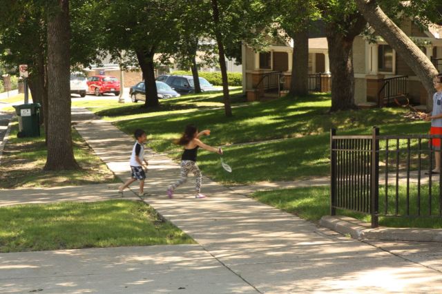
Many would describe Sage Holben as a neighborhood activist. A more accurate characterization is neighborhood builder. Sage’s neighborhood building began in 2003 when she moved to Dayton’s Bluff, closer to her job as a librarian at Metro State University. Between walking to and from work, and door knocking and literature dropping for politicians, Sage became a familiar and friendly face around the area.

Since then, she’s brought neighbors of all ilk – young and old, Saint Paul natives and immigrants, apartment-dwellers and homeowners – together. Through group art projects, story times, movie nights, yarn bombing and community events, she’s worked to get her Dayton’s Bluff neighbors to better know each other.

There are several reasons residents around Fourth and Bates don’t know each other like generations ago. A major one was the loss of thousands of good paying jobs within the neighborhood with the closings of 3M, Seeger/Whirlpool Refrigerator Manufacturing and Hamm’s Brewing. Sage continued, “There could be 15 kids on this corner and they could go to just as many different schools and they come here and they don’t know each other. What is the common thread? It’s no longer the same church. It’s no longer the same job place like Seeger or something. The only thread is being human.”
Art projects like the pavement painting and movie nights, often held outside have been big draws. “I started showing movies so that I could get to know more of the kids. Every weekend we would show Friday or Friday and Saturday. The rule would be that it would be something that if somebody were driving or walking down the street they wouldn’t be embarrassed by what they saw.”
Perhaps surprisingly, Sage told me that she doesn’t always meet the parents of children she interacts with. “There were five girls who came out to paint last night. We had a talk about being careful about whose house you go into and the same with some boys were over. Kavon from next door was over with his friend Melvin and I talked with them about how you don’t just go into anybody’s house, even though you may think you know them.”
Sage has befriended many neighbors but among the most memorable is a young man who lived a couple blocks down and had been beaten up in his apartment. “He knew me from saying hi to him at the library. His arm hurt and he wasn’t being given the medical care he needed. Also the police weren’t doing anything about his case. There were about six men who jumped him and he was in pretty bad shape and he asked me whether I would advocate for him with medical and police. So I did and he gave me a new perspective of what it is to be a young black man.”
Some friendships continue after people move, Sage told me. “When I moved in I got to know the kids who were then about 12 years old 14 years old. Now, they’re 20 something and several of them still stop over and ask if is there anything that they can do.”
That’s one of the many reasons that, in spite of it’s challenges, Sage loves where she lives. “It’s a fantastic neighborhood. People really do care.” And though Sage didn’t say it, she’s another reason her neighborhood is so nice.
Here’s the map of this ride.
Always a fun and interesting read
Thank you Don. Great to hear from you.
A great fun way to learn about the city we live in, it’s current times as well as its past lives, all presented in a well written and easily digestible nuggets.
Marcus, thank you for reading the blog and your nice comments. I hope it prompts you to see some other parts of our great city.
Wolfie
And get on my bike to do it.
Biking is a great option but it’s not necessary!
Great read, as usual. In the late 60’s a friend and coworker at the U of M took me by his home in Mt. Airy. He lived there with his elderly parents. His father had worked for the railroad, and had (I think) bought the house from them when he retired. It was a tiny affair, with those faux-brick asphalt shingles for siding. Although the house was tidy and could charitably be called “cozy”, I remember being shocked that people were still living in such conditions.
By the way, Wolfie, you might want to explore a bit farther east sometime. It’s a bit of a rough neighborhood these days, but you might enjoy visiting the Dari-Ette drive-in on Minnehaha, one of the last real drive-ins in St. Paul. They have old-school drive-in food but with a twist: it’s Italian. A burger basket comes with a choice of fries or spaghetti. A lot of other interesting sights in the area as well.
bolobilly, thanks for your insightful comments. I’d love to know more about your friend’s place in Mt. Airy! Let me know if you have more to share.
I have been east multiple times on my bike but not in the neighborhood of the Dari-Ette yet. I’ve never stopped there but my daughter has the same high opinion of Dari-ette as do you. Parts of the East Side are on my list for this summer. If you have any places I should see or people I should talk to (you included) let me know.
Thanks, Wolfie
How on earth do you do this, Wolfie? You somehow combine all these wonderful historical and architectural observations with vignettes about the people who live in these neighborhoods that make St. Paul seem so vibrant and ALIVE. (Like the story of Bonnie Erickson. Thank goodness there are intrepid souls like her to restore these old houses! Or Sage Holden and her yarn-bombing, movie-showing ways.) If there’s such a thing as a bicycle-poet laureate, I nominate you for the post.
Heidi, you have a way with words that I wish I could get close to. YOU are the poet. I couldn’t agree more about people like Bonnie and her husband who believe so in preserving our gorgeous old homes and put their sweat and money behind it.
BTW, I hope you’re getting close to another post. I’ve ready for another post of fabulous photos!
Thanks for following and your always delightful comments.
Wolfie
Aww, Wolfie — you sure know how to make a gal’s day. Thank you for your kind words. And thank you also for the motivation to get on the stick and post something already! I will endeavor to oblige you this very week.
Fascinating! I’ve lived in Saint Paul for 27 years and didn’t know Bethesda Hospital existed. We have taken our bikes on the Bruce Vento Trail multiple times but never ventured out onto the city streets on the east side. Thanks for alerting me to the hidden wonders of our capital city.
Thank you Andrew. This city is full of hidden treasures. Next time you’re on the Vento trail, head over to nearby Swede Hollow. It is another gem.
Thanks for reading and taking the time to comment.
Wolfie
I always get excited to see a new post pop up. Thanks for sharing!
Hi Kp, thank you for your nice comment and for reading the blog. If you ever have an idea for a story please let me know.
Wolfie
Reading your posts are a pure treasure. I detest “cleaning up” my e-mail. Then I come onto one of your “gems” and all seems right with the world. Such a wealth of St. Paul history, and the people you meet and interview make your accounts so human and endearing. Keep up the great vibes!
Hi Kelly. You made my day with your very nice comment. Thank you very much. And thanks for following along.
Wolfie