June 12, 2016     Midway, Frogtown (Rondo), North End, Como Park    17.5 Miles

Lex & Central Lot IMG_7344

There is a lot (an undeveloped property, not a large number of things) on the southeast corner of Lexington Parkway and Central Avenue. This rectangle of grass puzzles me for several reasons. First, it’s on a very busy part of Lexington, just north of St. Anthony Avenue (the I-94 frontage road) yet it’s inconspicuous.

Someone keeps the grass cut.

The lot is enveloped by a chain link fence, likely to deter people from turning it into a de facto dump or party zone. Next, look at how well-kept it is. Based upon the size, I speculate there once was a house here. How long has it been void of a house or business? Why is it still?

Frogtown

The light colored house in the front of the lot was the original to the property, constructed in 1927.
The light colored house in the front of the lot is the original to the property, constructed in 1927.

This is 1041 Van Buren Avenue. In reality, there are two homes here. Note the maroon structure behind the bushes, toward the back of the property. I’m sure this is an example of a so-called alley house, a second residence on a property located near the alley. Frogtown has the greatest number of alley houses in Saint Paul, according to Saint Paul Historical website.

Ramsey County property records say this one story, 480 square foot house is from 1944.
The alley house, in the foreground, sits atop a two car garage. You can see the back of the main house in this shot.

Back on the bike for about three blocks before I stopped again, at Seminary and Chatsworth.

This is the back side of the building shared by TerryBear Urns and River of Goods. For some 50 years a bowling alley, Minnehaha Lanes, was in nearly the same spot.

Minnehaha Lanes Bowling Alley was built here in 1957 and lasted for 50 years. Before that, this area was part of an unregulated dump. According to the Minnesota Pollution Control Agency, concrete, glass, wood, brick, porcelain, and ash were among the items uncovered and removed during cleanup after demolition of Minnehaha Lanes. A restaurant, nightclub and pro shop also occupied portions of the site.

The front entrance of 946 West Pierce Butler Route, which is shared by TerryBear Urns and River of Goods home decor.
Minnehaha Shopping Center, meanwhile, is on the southeast side of the same intersection.
Minnehaha Shopping Center, meanwhile, is on the southeast side of the Seminary and Chatsworth intersection.
Minnehaha Mall reflects the neighborhood residents who shop there.
Minnehaha Shopping Center, (also called Minnehaha Mall) reflects the neighborhood residents who shop there. BonXai Hmong catering and the Sudanese American Community Association are two of the business in the shopping center.
Three businesses are in this part of the shopping center, south of the main building. If M’haha Cleaning Center hasn’t been here since the mall opened, it’s been are around for a long time. What a great sign, by the way.
The mundane TerryBear building is bordered by a wonderful green area full of plants and flowers called Our Village Garden.

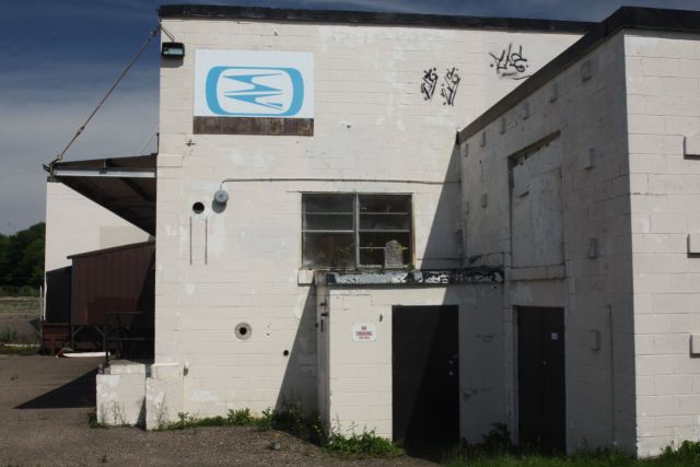
Our Village Garden is one of seven Frogtown Green parks and gardens in the neighborhood. According to its website, Frogtown Green is primarily a volunteer organization working to maintain parks and gardens within Frogtown.

Wilder Square Co-op, built in 1974, is a 163 unit coop for low to moderate income adults and families. Located at 750 North Milton Street, it is just across Milton from the Minnehaha Mall.
Wilder Square, built in 1974, is a 163 unit co-op for low to moderate income adults and families. Located at 750 North Milton Street, it is just across Milton from the Minnehaha Mall.

There are places around the city where there is an intermingling of residences and businesses that seems haphazard. My theory is that this is attributable to the way the city grew and a lack of or changes in zoning regulations over the years. Much of Pierce Butler Route is an example of this. The north side of Pierce Butler Route is primarily an industrial corridor sprinkled with the occasional house. There is a single block where another street – Hubbard Avenue – is squeezed in north of Pierce Butler and south of the heavily used BNSF railroad tracks through the Midway. That block of Hubbard is between Victoria and Avon.

The one block of Hubbard Avenue that is north of Pierce Butler Route is light industrial with one exception.
804 HubbardIMG_7420
The one and only home on Hubbard, 804, is at the corner with Avon Street.

Back on Pierce Butler, and one block east, the north side suddenly becomes residential for the block between Avon and Grotto.

On Pierce Butler the western-most house on the block between Avon and Grotto is 799.
Meanwhile, these homes are on the same block as 799 Pierce Butler, but are the closest to Grotto.

The Great Northern Business Center North at Atwater Circle and Topping Street grew out of what was for many years the St. Paul Foundry Company property, and more recently, Maxson Steel, which was shuttered in 1986. There is more than a century of history to this site, which is tied closely to the rise and fall of the fortunes of the local railroads.

The entrance to Great Northern Business Center North at Topping Street and Atwater Circle.

According to company notes from 1963, St. Paul Foundry and Manufacturing was founded on Saint Paul’s East Side in 1863. Its main products were cast metal parts for the Great Northern Railroad.

Twenty years later the company relocated to Como Avenue and Topping Street (today the site of The Great Northern Business Center North). Company minutes from 1883 list 2,000 shares of stock outstanding, and James J. Hill as the largest stock holder, with nearly 50% of it in his possession. It’s no wonder the St. Paul Foundry’s biggest customer for many years was Great Northern Railroad.

An advertisement for the St. Paul Foundry from the 1916 Saint Paul City Directory. Courtesy of Minnesota Historical Society

The St. Paul Foundry property covered some 22 acres of land in the North End. Company records say buildings occupied about 300,000 square feet of that.

Edit Post ‹ Saint Paul By Bike-Every Block of Every Street — WordPress.com
This aerial photo of the St. Paul Foundry gives an idea of its size. In 1921 when this picture was taken, the foundry property covered more than two square blocks. I believe Dale Street is the road in the foreground. Photo courtesy of Minnesota Historical Society

One building, the company office at 500 Como Avenue near Dale, stood out from the factory structures. It was newer than the foundry buildings, and distinguished architect Clarence H. Johnston Sr. penned the handsome design, featuring a brick and stone exterior, arched windows on the first floor, and large eaves with exposed beams.

The beautifully designed and constructed St. Paul Foundry, then Maxson, headquarters building was at 500 Como Avenue.
The beautifully designed and crafted St. Paul Foundry, then Maxson, headquarters building was at 500 Como Avenue. In 2000 the building was demolished. Photo courtesy Minnesota Historical Society
The Improvement Bulletin publication from December 22, 1910 mentioned the building would have plumbing and hot water heating, apparently luxuries at that time.

As the years passed, cast metal fell out of favor with many companies and was being replaced by fabricated structural steel. St. Paul Foundry kept up with industry trends. In the 1940s, locomotive parts became less important and workers produced fabricated steel and iron for buildings, such as Saint Paul Union Depot, the Lowry Hotel, and the St. Paul Fire & Marine Insurance headquarters. Prisons and jails became one specialty of the company.

Stillwater prison advertisement in a St. Paul Foundry catalog. The foundry made the steel for prisons in Minnesota, Washington State, Missouri, Illinois, Colorado, and Michigan.
Prison advertisement in a St. Paul Foundry catalog from the 1940s. The foundry made the steel for prisons in Minnesota, Washington State, Missouri, Illinois, Colorado, and Michigan.
Light post casting was another successful line of products from the St. Paul Foundry.
Lamp post casting was another successful line of products from the St. Paul Foundry.

The St. Paul Foundry was purchased in 1945 by R.H. Maxson of Canton, OH, but the company name remained unchanged until 1968, when it became the Maxson Steel Corporation. Maxson Steel continued producing various steel products and specialized rail cars for railroads, utilities and construction companies into the mid-1980s.

A custom rail car built by Maxson for Union Pacific Railroad. Photo courtesy Ted Larson Collection and trainweb.org
A custom rail car built by Maxson for Union Pacific Railroad. Photo courtesy Maxson, Ted Larson Collection and trainweb.org
Another example of the specialized rail cars produced by Maxson in the company's later years. Note the Maxson headquarters building in the background. Photo courtesy Ted Larson Collection and A custom rail car built by Maxson for Union Pacific Railroad. Photo courtesy Ted Larson Collection and trainweb.org
Another example of the specialized rail cars produced by Maxson in the company’s later years. Note the Maxson headquarters building in the background. Photo courtesy Maxson, Ted Larson Collection and trainweb.org

Maxson Steel closed in 1986 and the site was sold a short time later. In the late afternoon of May 24, 1990 highly combustible pellets of recycled paper stored in one of the former Maxson/St. Paul Foundry buildings burst into flames.

Firefighters battled an intense fire at a warehouse at the old Maxson Steel facilities. Photo courtesy Joseph Heitzinger, Richard L. Heath, The Extra Alarm Association of the Twin Cities, Inc.
A May 25, 1990 article in the Minneapolis Star Tribune about the blaze.

Witnesses said flames rose 100 feet in the air. It took the Saint Paul Fire Department four alarms and 16 rigs to contain the inferno, but not before it set fire to three other buildings. Firefighters finally declared the blaze extinguished almost two weeks later, on June 4th , after causing $2.2 million in damages.

Through much of the 1990s, various city officials and neighborhood groups pushed, cajoled, argued and clamored for funding to clean up the former Maxson Steel/St. Paul Foundry property which had become a blighted eyesore.

A Minneapolis Star Tribune article from ???? talks about redevelopment plans for the Maxson Steel site.
A Minneapolis Star Tribune article from 1990 talks about redevelopment plans for the Maxson Steel site.
Perhaps the most visible sign of change to the North End industrial property was the felling of the 100 foot tall foundry smokestack.
Perhaps the most visible sign of change to the North End industrial property was the felling of the 100 foot tall foundry smokestack. This photo is from the Star Tribune newspaper.

One hundred years of heavy industrial use left many toxic pollutants in the soil and groundwater. Cleanup and site preparation took three years and some $30 million, but the Saint Paul Port Authority now had land ready for redevelopment. The Port Authority dubbed the former Maxson site the Great Northern Business Center North.

The plat map from 1908 showing the location of the St. Paul Foundry Company grounds and areas nearby. From Curtice's revised atlas of the city of St. Paul.
The plat map from 1908 showing the location of the St. Paul Foundry Company grounds and areas nearby. From Curtice’s revised atlas of the city of St. Paul.
The Great Northern Business Center (former St. Paul Foundry) area today. Courtesy Google Maps.

Since the early 2000s, new streets replaced railroad tracks. Warehouses, light industrial buildings and medical device manufacturing and jobs took the place of the foundry structures. Lawns, trees, sidewalks, and parking lots supplanted a dirty, barren heavy industrial waste site.

Appliance retailer Warners' Stellian company headquarters...
Appliance retailer Warners’ Stellian company headquarters and
Lexion Medical on Atwater Circle is a medical device manufacturer.
Lexion Medical, a medical device manufacturer, are both on Atwater Circle.
Perfectly aligned trees, green grass, and sidewalks along the boulevard on Atwater Circle.

My trip continued north about half a mile to Lawson Avenue and Kent Street, along which single family homes dominated to the west. On the east side of Kent the Shiloh Missionary Baptist Church seemed to arise from a large, flat parking lot.

Shiloh Missionary Baptist Church opened this new worship space in mid-2007 after about 40 years at Hague Avenue and Victoria Street in Rondo.
The plaque on the Shiloh Missionary Baptist Church Building on Kent Street.

Immediately north of Shiloh sat a former factory, obviously shuttered for at least a few years. It took a lot of Internet searching to learn this was the home of Jefferson Smurfit, which made packaging for consumer products, including decorative food boxes and bags and pet food bags, for about 50 years. (I chuckled when I first learned the name of the company. I cant help but imagine the employees as small blue human-like creatures.)

The rusting chain link fence, weed-infested lot, boarded windows, and debris piled by the building was a strange contrast to well cared for homes on the three blocks surrounding the old printing facility.
This blue logo was the only identifying mark on the building; not even the address was posted anywhere.
Plywood sheets appear to be doing their job keeping interlopers from entering the plant through the former main entrance.
However, the windows were no match for trespassers.
The Jefferson Smurfit factory was closed for about 10 years at the time of my visit.
Looking southwest from the parking lot.

Big changes to this site are in the works, which was purchased by the Saint Paul Public Schools a couple months after this ride. Construction of the new RiverEast School is moving toward completion with a fall 2018 opening scheduled. Some of the factory is being renovated to serve the new school and portions have been demolished.

According to the SPPS website, RiverEast School is for kindergarten through 8th grade students who have “mental and behavioral health needs” and “have not been successful in traditional classrooms.”

The school district expects up to 80 students and 60 staff members will occupy RiverEast. The building has been bestowed with a new address; 1055 Mackubin Street, replacing the 1050 Kent Street when it was Jefferson-Smurfit.

The Saint Paul Public Schools website has many construction shots at https://www.spps.org/Page/25805.

The last stop of this ride was Marydale Park, a mere block north of the departed Jefferson Smurfit/future RiverEast School.

Marydale Park, about four square blocks in size, is named for it’s location at the southeast corner of Maryland and Dale. Loeb Lake is in the extreme background.
The northwest edge of Marydale Park sits at the buys corner of Maryland and Dale, the southeast entrance is at the quiet residential intersection of Mackubin Street and Jesamine Avenue.
The northwest edge of Marydale Park sits at the buys corner of Maryland and Dale, the southeast entrance is at the quiet residential intersection of Mackubin Street and Jessamine Avenue.
A big draw at Marydale Park is the Loeb Lake fishing pier on the east (Mackubin Street) side of Loeb Lake, where at least a dozen people were fishing or relaxing..

“William” was one of the folks dipping a line in Loeb Lake on this beautiful day. He came to the lake for the first time this season couple weeks ago at his son’s suggestion. “We came and we caught somethin’ like 13 big mouth bass, we caught three walleyes. We caught some sunnies. Yeah, so it was a real good catch; a real good day for us that day. So I’ve been coming out every day ever since.” William said, laughing.

William reels the line in.

William told me that he loves fishing, but there’s more to his daily visits to Loeb Lake than fun. William said he’s preparing for the family July 4th celebration. “We catch (fish) from May to the last week of June, and we freeze ’em and then we start cleaning up and getting them prepared for fish fry that we do every Fourth of July.”

A couple years back, William got bored with the traditional July 4th fare of chicken, ribs, hot dogs, and hamburgers, so he turned the menu on its head by serving fish.

“I cooked some on the grill and deep-fried like maybe 50.” William had no idea what a success the fish would be. “I came back the next morning with my daughters to get some more and the fish all the fish was gone, but the ribs and chicken, all that was still there.”

William has the best luck using leeches and worms when fishing Loeb Lake.

I asked William about his recipe for the fish. “I season them with season salt, black pepper. And with the ones on the grill, I season them up, wrap them in aluminum foil and smoke them on the grill and some other fish we deep fried.”

Another angler showed off her catches.

I wished William and the other fisher folk luck and set out to explore the rest of Loeb Lake and Marydale Park. It turns out that the Department of Natural Resources stocks the lake with bluegills, and sunfish, crappies, bass, northern pike, walleye, catfish and bullheads can also be caught from the pier or shore. The eight acre lake is 28 feet deep in places.

The Loeb Lake pier as seen from the western shore.

Marydale Park and Loeb Lake are environmental success stories. According to the City of Saint Paul website the city acquired both in 1969 after decades of use as a chemical and waste disposal site.

Picnic tables, a playground, bathrooms, and Loeb Lake make Marydale Park a great picnic spot.

Here’s the route map for this ride.

3 Comments

Leave a Reply to Donald EmpsonCancel reply